Canyoneering Route Description
Limbo Canyon - 4A III R
Ticaboo Mesa, Utah.
03-03-12, 3 people, 1 Day (Travel time in route 5.5 hours)

03-08-15,
7 people, 1 Day (Travel time in route 6.4 hours)
Time Required - 6 to 7 Hours
Distance - 2.6 miles Total, 0.4 miles Technical
Rappels - 5 Rappels, Longest Rappel 120 feet.
Elevation Range - 4965 - 4115 Feet
Shuttle Required -No Vehicle - High Clearance
(possibly 4WD if road conditions are bad)
Permit Required - No
Rappelling and anchor gear, Ropes and or pull cords for rappels up
to 120 feet and 50 feet of 1 inch webbing for sling placement. Wet
suits may be needed on cooler days when the canyon is full of
water. If you are not cold tolerant and expect water in the canyon a
farmer john would be nice since most of the water is only waist deep
if present.
This canyon also requires
potshot and back pack
anchors for some of the
drops. Bring potshots
or the like along with the
knowledge to use them.
The Dantes are a
collection of
Canyons offering short and
challenging routes in the Ticaboo
Mesa area. More than one of
the Dante Canyons can be done in a
day if a longer day is desired.
The canyons in the Dante system go
by the names Purgatory (aka Dave's
Not Dead), Inferno, Limbo and Paradiso.
Natural anchors are
used in the Dante's. While
enjoying the Dante Canyons, please
pay close attention to how you set
up anchors and try to minimize or
eliminate creating more rope
grooves. Over the years only
minor rope grooves have been
inflicted on the canyon walls.
Please try to follow in the foot
steps of those before you and keep
rope grooves to a minimum.
Note
/ Navigation Warning:
The exit route up out of the Dante
Canyons is difficult to explain
(written or verbal). Be aware
you may have some route finding to
do on your way up out of the system.
A GPS may be helpful if you plan to
use the GPS coordinates on from this
route description.
Another fun note is
the large wash that Purgatory dumps
into is sometimes referred to as
Bright's Wash, named after William
Bright.
Limbo Canyon offers
a little more challenge than a
typical rap and go canyon.
Some of the drops will require
potshots or backpacks as anchors.
The layout of the drops is fairly
forgiving and is a good place to
practice these techniques. It
is a good idea to have someone along
on the trip that has used this style
of anchoring in the past.
The R rating for
Limbo Canyon is due to the mandatory
silo crosssing.
There is a
mandatory silo crossing just after
rap 2. For most people a back
on one wall and feet o the other is
sufficient reach to cross this silo.
The silo crossing is not technically
difficult but is a definite mind
game as you look over it and realize
you have to cross it. You will
be about 30 feet off the deck while
crossing part of this silo with now
way to add realistic protection.
Be prepared for this scenario before
you decide to do Limbo Canyon.
Some of these raps
can be down climbed but are safer
with a rope so they have been called
raps. On the flip side some of
these down climbs will be safer with
a hand line. Depending on what
your group does the rap count may be
different for you.
Warning!!:
Don't pull ropes over rock features that can be used as anchors. They
will eventually get sawed off.
Warning!!
It does not take very much rope movement to quickly saw through
sandstone!
After only a few people saw a rope over a small feature, it can easily
break off and be gone for ever.
If you a sandstone feature as your anchor leave a webbing anchor and
rapid on it so the rope does not saw on the rock. Or if the drop
is short enough and geometry is correct flick the rope off of the fin
from below.
DO NOT just pull your rope along the feature to retrieve your rope!
This is a good example of why it is important to THINK about what your ropes do as you descend a canyon.
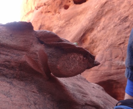
Picture taken 03-03-12.
I mention this because someone on a decent of
Limbo Canyon did exactly that.
A rock fin that is commonly used as an anchor is now cut almost in half
and will soon be gone forever if this continues to happen.
To get to the Trailhead
Note:
There is a maze of roads on Ticaboo Mesa making it a good idea
to study the map ahead of time and keep a close eye on the map
as you drive.
From Hanksville, UT., drive south on highway 95 for 26 miles to
the junction of highways 95 and 276.
From the junction, drive south on HWY-276 for 25.6 miles then
turn left (east) onto BLM dirt-road 13400 between mile markers
25 and 26 (extTicaboo1).
About 1.5 miles from the highway is a junction (TicabooDP-01)
of BLM roads, 13400 continues east and 13410 branches off to the
south. Continue east on BLM road 13400. Note: If you were headed
to the Smith Fork area you would turn south onto BLM road 13410.
About 2 miles farther is another junction
(TicabooDP-02) of BLM roads, 13400 continues east and 13420
branches off to the south. Continue east on BLM road 13400.
Note: BLM road 13420 to the south goes out to Cane Spring Well
about 1.25 miles south.
About 0.2 miles farther is short side road (TicabooDP-03) on the
left (north) that goes to a camp area.
Stay right to
continue on BLM road 13400. Beyond this point the roads
will have intermittent rough sections.
About 0.37
miles past here is a fork in the road where the two roads rejoin
a short distance later. The low road is typically the
smoothest.
About 1.7 miles farther is another junction (TicabooDP-04) of
BLM roads (13400 continues north-ish and 13430 branches off to
the south).
Continue north on BLM road 13400.
Note: If you were going to the roads between Warm Springs Creek
and Sevenmile Creek, you would turn south onto BLM road 13430.
About 0.3 miles farther is another junction (TicabooDP-05) of
BLM roads (13400 continues northeast and 13440 branches off to
the north).
Continue straight northeast on BLM road 13400.
Note: BLM road 13440 to the south goes out to Colt Spring Well
about 0.4 miles north.
About 0.5 miles farther is a junction (TicabooDP-06) of BLM
roads (13400 continues northeast and 13450 branches off to the
north).
Continue straight northeast on BLM road 13400.
About 0.9 miles farther is a junction (TicabooDP-07) of BLM
roads (13400 continues northeast and 13430 branches off to the
south).
Turn south onto BLM road 13430.
Note: If you were
going to Tough, SF Ticaboo or Sleepytime Trio Canyons you would
continue northeast on BLM road 13400.
About 700 feet farther is a fork in the road (extWarmSpring).
At this fork stay left to continue toward the East Branch of
Seven Mile Creek.
About 0.4 miles farther is another fork in the road
(ext7MileCkEB). Veer left (east) to continue toward the
Dante's.
About 1.1 miles farther is a junction where a side road joins in
from the southwest (TicabooDP-08). Veer left (east) to
continue toward the Dante's.
About 0.4 miles farther is a junction where a side road joins in
from the southwest (extTicabooMesa). Stay left and follow
the road as it turns and begins to head north.
About 1 mile farther is a major road junction (extDantes).
Turn right (southeast) to continue toward the Dante's.
About 1 mile farther is a junction where a road joins in from
the left (extTicabooCamp). Continue straight (southeast)
toward the Dante's.
About 0.2 miles farther the road dead ends (tDanteCanyons1).
Park here to start the Dante Canyon routes.
To leave the Exit Vehicle / Escape Pod
No exit vehicle is needed. This is done as a loop route.
GPS coordinate information listed at the bottom. For information about waypoint naming and map symbols, refer to the
Glossary page.

Click the links for maps of the route.
Map of the Drive overview.
Map of the Drive segment 1 Zoomed in.
Map of the Drive segment 2 Zoomed in.
Map of the Canyons overview.
Map of the Canyons section 1 Zoomed in.
Map of the Canyons section 2 Zoomed in.
The Approach:
From the trailhead
(tDanteCanyons1) walk
south west into the
desert. A social
trail has started to
develop and it is a good
idea to continue to use
the trail to minimize
the impact on the area.
About 250
feet from the parking
area the social trail
will drop down into
a small shallow drainage
(wDanteEntRP-01).
Follow south east down
the small drainage about
100 feet to where the
drainage meets a steep
drop down a sandstone
wall (wDanteEntRP-02).
This is a steep drop of
about 20 feet to another
section of dirt desert
floor.
After dropping down the
sandstone slope follow a
worn path east along the
dirt for a little over
200 feet to get over to
the next section of wide
open slick rock
(wDanteEntRP-03).
Staying on the path
already carved out along
the dirt floor will help
keep foot traffic off of
the crypto biotic soil
in the area.
Once on the wide open
slick rock
wDanteEntRP-03) turn left
to walk (northeast)
and follow the shelf you
are on. About 500
feet along the shelf
contour around the top
of a minor side drainage
dropping down into
Purgatory Canyon which
is now on your left
(southeast).
After contouring around
the minor drainage,
contour along the shelf
as you wrap around to
the right and begin to
travel east then south
east. In about 300
feet you will contour
around the top of a
larger drainage which is
the top of Purgatory
Canyon (yPurgatoryTp).
Purgatory is also known
as Dave’s Not Dead).
If you were dropping
into Purgatory you would
find your way into this
slot.
To continue toward
Inferno stay on the
shelf and travel about
1000 feet south east
contouring around a
point. The
drainage you cross (jInferno)
about 1000 feet after
passing Purgatory is the
top of Inferno Canyon.
At this point Inferno
has not yet formed into
a menacing slot yet so
it may not appear to be
much of a drainage at
first glance. If
you plan to drop into
Inferno you would start
your way south down this
drainage.
To continue to Limbo
Canyon, continue
southeast along the
slick rock for about 700
feet to where you cross
over the top end of
another drainage (jLimbo).
This is the top of Limbo
Canyon.
The Canyoneering / Technical Section:
From the top of
the Limbo drainage on
the approach / exit
route, go south down
into Limbo.
A little over 100 feet
down canyon will be the
first down climb which
is easy stem style and
sloped. This is
marked as the top of
Limbo Canyon (yLimboTp).
Down climb about 8 feet
in a sloped chute like
slot to a pothole below
that could be knee of
thigh deep if full.
shortly after is another
pothole that may be
waist deep if full.
This second pothole can
be avoided but may be
difficult for some
people to do so.
Next galumph along
traveling over a few
more small pothole like
features. This
first section is only
about 100 feet long then
the drainage opens up
into a wide area with
some sand.
On the other side of the
wide sandy area starts
the next narrow section
(wLimboRP-01). In
the first 250 feet of
this narrow section are
3 down climbs each about
6 to 8 feet. None
of these are overly
difficult but some may
want a hand line for
them. There are
also a few potholes that
will be in this section
that can be about waist
deep if full of water
and will be unavoidable.
If the canyon is wet
plan on wading in a few
spots here. Other
than the few small
potholes travel is a mix
of walking and
galumphing.
About 250 feet down
canyon into the second
narrow is a sloped
elevator like down climb
of about 10 feet
(wLimboRP-02).
The walls are narrow
enough here that you can
stem over this drop and
drop down where it feels
comfortable.
Continuing down canyon
are 2 or 3 more down
climbs of about 6 feet
and a few spots where
water can get up to
waist deep if the canyon
is full.
About 175 feet down
canyon of the elevator
is a drop of about
25 feet (wLimboRP-03). The first
half of this drop is
down climbable but the
lower half is steeply
sloped and almost
vertical. A hand
line works well for all
but the last person.
The last person can use
a potshot or back pack
as an anchor then pull
it over the edge after
getting down.
Capturing the last
person could be awkward
for those at the bottom
as the footing here is
not good.
The potshot is likely
the better option since
there is a convenient
lip near the top for the
placement of the
potshot. A pot
shot half full or a
little more depending on
how wet the sand is
works well.
Remember to maintain
full body contact on the
rock as you slither down
the drop so there is
less force applied to
the potshot above.
About 30 feet down
canyon is another drop
of about 20 feet.
All but the last 50 feet
of this drop is easily
down climbed. A
hand line for all but
the last then a partner
capture for the last man
down works well here.
About 50 or 60 feet down
canyon is a drop of
about 20 feet which is
rap 1 (dLimbo-R1).
Rap 1 (dLimbo-R1) drops
about 20 feet and can be
anchored from a rock fin
on the LDC side about
head high and 20 feet
back from the drop.
People on past descents
have pulled the rope
over this rock fin and
almost sawed it in half.
Please do not do this.
Leave webbing or flick
the rope off of the fin.
Do not pull the
rope around this fin to
retrieve.
Another option that
works well is to use a
potshot filled with sand
at the top of the drop.
With a pull rope tied to
the back side of the bag
the potshot is pulled
from the bottom of the
rap dumping most of the
sand before dropping
down to you.
Only the first 15 feet
of rap 1 needs the rope.
The last 5 feet can be
scrambled / stemmed
between twisting walls.
Between rap 1 and rap 2
are a couple pools to
cross through that could
be a bit over waist deep
if full.
Rap 2 (dLimbo-R2) is
about 100 feet down
canyon of rap 1.
Rap 2 is anchored from a
small choke stone in the
V shaped slot at the top
of the drop. The
total rope length needed
for rap 2 is about 50
feet. The first 15
feet of the rap is an
easy down climb and the
remainder could arguably
be called a drop that
only requires a hand
line. Since a rope
is required I am calling
it a rap.
At the bottom of Rap 2
is a large pothole that
could be about waist
deep if full of water.
This pothole has a sand
filled floor so it could
be deeper if foods scour
this out.
Shortly after rap 2 is a
silo that needs to be
crossed. While
crossing over the silo
you will be 30 or so
feet above the deck.
For most people a back
on one wall and feet o
the other is sufficient
reach to cross this
silo. The silo
crossing is not
technically difficult
but is a definite mind
game as you look over it
and realize you have to
cross it. You will
be about 30 feet off the
deck while crossing part
of this silo - with no
way to add realistic
protection. You're
on your own over this
thing.
Note / Warning:
About halfway across the
silo is a large loose
flake of rock on the LDC
wall. This large
flake is not visible
until you get right up
to it. What makes
this noteworthy is this
flake sits exactly where
you will want to put
feet or hands to support
yourself. If you
are not paying attention
you may place weight on
this flake and it could
break sending you down
the silo with that
flake. Keep this
in mind when crossing
and remember to watch
where you place your
body parts as you cross
here.
Down canyon of the silo
is a narrow left leaning
section to stem /
galumph in before
getting to a short
section of easy walking
in sand.
Just after the short
sandy walk is a down
climb of about 5 feet to
a possibly waist deep
pool.
Just after is a drop of
about 10 feet into
another pool. The
pool below the 10 foot
drop could be up to
chest deep if full.
If the pool is only
waist deep there are a
few features on the RDC
side that will allow
skilled climber types to
get around the pool
without getting wet.
But most everyone will
end up in the water
here. Just after
this pool is another
drop of about 15 feet
into another pool
(dLimbo-R3).
Rap 3 (dLimbo-R3) is
about 10 feet down a
vertical wall and will
require and anchor at
the top. A meat
anchor can be provided
from the top of the drop
for all but the last
person. A pack
anchor works well at
this drop for the last
person.
Note:
If the pack you use is
too light it will not
support the last person
down or if too heavy it
will be very difficult
to pull. Keep this
in mind when setting up
the pack anchor.
One rope tied to the
down canyon side of the
pack is used to rappel
from. Another rope
tied to the up canyon
side of the pack allows
the pack to be pulled
and rolled up over the
start of the lip.
A good idea is to use as
light a pack as
possible, maintain full
body contact on the rock
as you rap / slide down
and rap fast so you put
less force on the pack.
Just after rap 3 the
canyon veers right just
before getting to a rock
fall debris area
(wLimboRP-04).
Climb up, over and
around the rock fall
debris on the LDC side.
Route find your way back
down to the canyon floor
down through the down
canyon side of the rock
debris.
Shortly down canyon of
the rock fall debris is
a down climb through a
little more rock fall
debris just before
getting down to the top
of rap 4. This
down climb some people
may want a hand line
for. Drop down
this by slithering down
the drop using body
friction.
Rap 4 (dLimbo-R4) is
anchored from a rock
embedded in the sand
about 15 feet back from
the drop. Rap 4
then drops vertical for
about 15 feet.
Note:
Rap 4 can be down
climbed but may feel
sketchy to do so.
To down climb sit at the
top of the drop, put
your back on the RDC
wall and slide over the
edge. As you slide
over extend your feet
out to the LDC wall and
aim for a half moon
shaped pocket.
After getting your feet
into the pocket the down
climb is an awkward
sliding stem. Take
your pack off for this
down climb as it will
force you out of the
crack you are trying to
stay in.
After rap 4 is easy
travel with a mix of
walking in sand and some
easy scrambles. Just
before reaching rap 5 is
a narrow slot to down
climb into.
Rap 5 (dLimbo-R5) is
about 400 feet down
canyon of rap 4.
Rap 5 is anchored from
choke stones at the top
of the drop and is a two
stage rap. You
will need about 120 feet
of rope travel for rap
5.
The start of the first
stage of rap 5 is a
little awkward to start
in a narrow slot
followed by about 15
feet of free hang.
The total drop of the
first stage is about 35
feet. Below the
first stage is a huge
ledge with a really cool
looking pothole in it
that would likely be a
mouse in a bucket kind
of thing if you went in
it while dry. The
pothole is very easy to
walk around on the huge
ledge.
The second stage of rap
5 drops over a couple
subtle ledges to a pool
in the sandy wash below.
Depending on water
levels in the wash the
pool at the bottom of
rap 5 could be waist to
chest deep. In
most cases you will be
able to get off rope and
traverse to the LDC side
and get wet to your
knees at most.
The spring here is said
to be the most reliable
water in the system and
has water year round.
About 200 feet down
canyon of rap 5 is a
large bowl like area on
the LDC side (yLimboBt).
I chose this semi
arbitrary point to mark
as the end of the
technical section.
The Exit:
From the
bowl like area on the
RDC side (yLimboBt), it
is about 0.25 miles to
the end of the canyon
where it dumps into
another drainage.
About 200 feet before
reaching the junction of
drainages
(wDanteExtRP-02) walk up
the dirt slope about 200
feet to the base of the
cliff band and scramble
up a drainage looking
indent in the cliff
band. After scrambling
to the top of the indent
(wDanteExtRP-03) you
will be topped out on a
large ledge.
Once on the large ledge
turn right (south) and
traverse along the ledge
for about 200 feet
around the tip of a
point along the ledge to
the start of a bowl
shaped indent
(wDanteExtRP-04).
Walk up the bowl shaped
indent and climb up the
ledges to get to the top
of the bowl and traverse
north a little over 100
feet up onto the ridge
(wDanteExtRP-05). This
ridge is running between
Limbo Canyon which is on
the left (north west)
and Paradiso which is on
the right (south east).
Once up on the ridge
(wDanteExtRP-05) walk
north east on the
sandstone ridge.
Continue north east up
the ridge for about 650
feet to a small knob to
go up over or around
(wDanteExtRP-06).
From the knob continue
north east about 350
feet to the start of
steep section of the
sandstone ridge to
scramble up
(wDanteExtRP-07). On
the climb up, there is a
good view to the right
(east) down into
Paradiso. The top out
of the climb is about 75
or 100 feet from the
bottom of the climb /
scramble. From the top
out continue up the
slope to about 200 feet
then drop down into a
drainage running across
the ridge
(wDanteExtRP-08).
The drainage crossing
the ridge
(wDanteExtRP-08) has a
sharp drop off on the
right (east) dropping
down toward Paradiso
Canyon. Walk over very
close to this drop off
and find a way to
scramble up the other
side (north) to continue
along the ridge. This
spot will be more of a
climb than a scramble
but an easy climb.
After getting up out of
the drainage crossing
the ridge, continue
north up the ridge about
200 feet to the stat of
a steep section of slick
rock to climb
(wDanteExtRP-09). The
scramble up the slick
rock here is not
difficult but hands will
be needed. The scramble
goes for about 400 feet
to the top out then
continues another 100
feet or so and drops
down into another
drainage running across
the ridge
(wDanteExtRP-10). At
the top out of the climb
you can see the cars
parked at the trailhead
about 0.6 miles to the
northwest if you look
close.
The drainage crossing
the ridge
(wDanteExtRP-10) pours
off to the right (east)
down into Paradiso and
to the left (west) down
into Limbo. Cross over
the drainage and
scramble up a sandstone
nose to continue up the
ridge.
About 200 feet after
getting up out of the
last drainage the climb
will top out and start
to curve left to the
northwest. Continue
about another 400 feet
and find a way to drop
down into the next
drainage crossing the
ridge (wDanteExtRP-11)
that is kind of deep and
narrow with a sandy
floor as you continue
northwest. After
dropping down into this
drainage follow it
northwest about 250 or
300 feet to where it
opens up in a very large
flat sandy ledge or
landing
(wDanteExtRP-12).
Continue across the
sandy landing and
continue along the
narrow drainage. A
little over 500 feet
after crossing the large
sandy landing area the
route will cross over
another drainage
(jLimbo). This is the
drainage leading down to
Limbo.
After crossing the
drainage that leads down
to Limbo (jLimbo),
continue northwest
across the sandstone.
About 700 feet after
crossing the drainage to
Limbo, the route will
cross over yet another
drainage that leads
south down to Inferno
Canyon (jInferno).
After crossing over the
drainage down to
Inferno, will be a large
wide open ledge or
shelf. Walk along the
ledge as it curves
southwest then to the
right to the north.
Walking along this shelf
or ledge will skirt
around a prominent point
on a cliff band and over
to the head of Purgatory
Canyon (yPurgatoryTp).
The head of Purgatory is
about 1000 feet after
crossing the drainage
leading down to Inferno.
Note:
If you are exiting after
completing Purgatory,
please take a moment to
walk down to rap 1 and
retrieve your anchor
webbing and rapid.
If you are completing
another canyon and feel
like taking the time you
can walk over and see if
any is left there you
can clean up.
Continue northwest from
the top of Purgatory
across the sandstone.
Traverse along the
sandstone on whatever
feels like a natural
route staying high but
well below the cliff
band on the right
(north). About 450 feet
after crossing the top
of Purgatory Canyon you
will cross over a small
drainage which is a
minor fork of the top of
Purgatory
(wDanteExtRP-13).
After crossing the small
drainage leading down
toward Purgatory, walk
west about 150 feet to
the base of the cliff
band where you can find
a spot to climb out
(wDanteExtRP-14). This
spot to climb out may be
difficult when wearing a
heavy pack. This spot
is steep and has only a
few hand holds for about
15 feet up the slick
rock band.
After climbing up the
steep 15 foot section of
the sandstone cliff
band, traverse up the
dirt slope traveling
south to get to the top
of the climb near the
trailhead. Then walk a
few hundred feet across
the flat desert to the
trailhead
(tDanteCanyons1).
Downloadable GPX files
available at
BG-Gear Store
(easier than manual entry and a great way to support
Bluugnome).
Waypoint naming convention and map symbol information can be found on the Glossary page.
Elevations are approximate.
BEFORE
manually entering coordinates set your system to WGS84 datum and Lat/Lon hddd.ddddd° coordinate format.
Inconsistent datum's and coordinate formats will result in location errors.
Click to show / expand the list of waypoints below........
| Limbo (1) - Drive to Trailhead |
- extTicaboo1
Lat/Lon (WGS84): N 37.69720
W -110.67138
Elev: 4,520 Feet
Exit off of highway 276 to get to the Ticaboo Mesa area. Turn east and leave the highway on a dirt road. Near Mile post 25.
- TicabooDP-01
Lat/Lon (WGS84): N 37.68607
W -110.65188
Elev: NaN Feet
Continue straight for the main area of Ticaboo Mesa. Or Turn right (south) here for an alternate route over toward the Smith Fork Canyons.
- TicabooDP-02
Lat/Lon (WGS84): N 37.67981
W -110.62886
Elev: NaN Feet
Road junction with faint road running to the south. Continue straight (east).
- TicabooDP-03
Lat/Lon (WGS84): N 37.68038
W -110.62628
Elev: 4,565 Feet
Exit to a spot to camp if the roads ahead are too rough.
- TicabooDP-04
Lat/Lon (WGS84): N 37.67963
W -110.60429
Elev: NaN Feet
Junction for a road going south. Continue straiaght (north east) to continue toward Ticaboo Measa. This road junction is near Wild Horse Springs.
- TicabooDP-05
Lat/Lon (WGS84): N 37.68389
W -110.60153
Elev: NaN Feet
Junction for a side road on the left going north. Continue north east toward Ticaboo Mesa.
- TicabooDP-06
Lat/Lon (WGS84): N 37.68667
W -110.59547
Elev: NaN Feet
Junction for a side road going north.
- TicabooDP-07
Lat/Lon (WGS84): N 37.69529
W -110.58385
Elev: NaN Feet
Turn off for a side road on the right. Turn right onto the side road and drive southwest.
- extWarmSpring
Lat/Lon (WGS84): N 37.69362
W -110.58484
Elev: NaN Feet
Stay right to go toward the main drainage of Seven Mile Creek and Warm Springs Canyon. Or Stay left to go toward the East Branch of Seven Mile Creek and Ticaboo Mesa.
- ext7MileCkEB
Lat/Lon (WGS84): N 37.69147
W -110.58014
Elev: NaN Feet
Turn right (more south) to continue toward the East Branch of Seven Mile Creek. Or veer left to continue toward Ticaboo Mesa.
- TicabooDP-08
Lat/Lon (WGS84): N 37.68412
W -110.56389
Elev: NaN Feet
Junction where a rod joins in from southwest. Veer left and continue east toward the Dantes.
- extTicabooMesa
Lat/Lon (WGS84): N 37.68397
W -110.55581
Elev: NaN Feet
Juntion where a road joins in from the south. Stay left and follow the road north to continue out toward the Dante Canyons. Or Turn Right and follow the road South to continue out toward Fiddlestix Canyon. The road to the south eventually loops around to meet the road by Seven Mile Creek.
- extDantes
Lat/Lon (WGS84): N 37.69594
W -110.55323
Elev: 4,995 Feet
Major junction. Trun right (southeast) to go toward the Dante's.
- tDanteCanyons1
Lat/Lon (WGS84): N 37.68666
W -110.53627
Elev: 4,965 Feet
Trailhead for the Dante Canyons.
|
| Limbo (2) - Approach |
- tDanteCanyons1
Lat/Lon (WGS84): N 37.68666
W -110.53627
Elev: 4,965 Feet
Trailhead for the Dante Canyons.
- wDanteEntRP-01
Lat/Lon (WGS84): N 37.68607
W -110.53681
Elev: 4,960 Feet
Drop into a small drainage here then follow down it to the south east.
- wDanteEntRP-02
Lat/Lon (WGS84): N 37.68590
W -110.53665
Elev: NaN Feet
Drop of about 20 feet down a steep section of a sandstone wall to more dirt desert floor.
- wDanteEntRP-03
Lat/Lon (WGS84): N 37.68575
W -110.53588
Elev: 4,845 Feet
Path through the dirt meets wide open slick rock here.
- yPurgatoryTp
Lat/Lon (WGS84): N 37.68697
W -110.53362
Elev: 4,835 Feet
Top entry for Purgatory Canyon.
- jInferno
Lat/Lon (WGS84): N 37.68642
W -110.53151
Elev: 4,785 Feet
Route crosses a drainage here which is the drainage leading to the top of Inferno Canyon. If exiting one of the Dante's, continue west across the sandstone. If descending Inferno, go south down the drainage toward the top of Inferno Canyon.
- jLimbo
Lat/Lon (WGS84): N 37.68569
W -110.52951
Elev: 4,670 Feet
Route crosses a drainage here which is the drainage leading to the top of Limbo Canyon. If exiting one of the Dante's, continue west across the sandstone. If descending Limbo, go south down the drainage toward the top of Limbo Canyon.
- yLimboTp
Lat/Lon (WGS84): N 37.68535
W -110.52948
Elev: 4,650 Feet
Top entry of Limbo Canyon. This is where teh fist down climb starts in the Limbo drainage.
|
| Limbo (3) - The Canyon, |
- jLimbo
Lat/Lon (WGS84): N 37.68569
W -110.52951
Elev: 4,670 Feet
Route crosses a drainage here which is the drainage leading to the top of Limbo Canyon. If exiting one of the Dante's, continue west across the sandstone. If descending Limbo, go south down the drainage toward the top of Limbo Canyon.
- yLimboTp
Lat/Lon (WGS84): N 37.68535
W -110.52948
Elev: 4,650 Feet
Top entry of Limbo Canyon. This is where teh fist down climb starts in the Limbo drainage.
- wLimboRP-01
Lat/Lon (WGS84): N 37.68490
W -110.52913
Elev: 4,593 Feet
Start of the second narrow section and where the canyon takes on the commited feel.
- wLimboRP-02
Lat/Lon (WGS84): N 37.68453
W -110.52840
Elev: 4,537 Feet
Sloped elevator like down climb of about 10 feet.
- wLimboRP-03
Lat/Lon (WGS84): N 37.68406
W -110.52820
Elev: 4,520 Feet
Two down climbs about 30 feet apart.
The first is about 25 feet with the second half being sloped and almost vertical where a potshot anchor from above is best for last man down.
The second drop is about 20 feet and all but the last 5 feet is easily down climbed. A partner asist works well at the bottom of this second down climb.
- dLimbo-R1
Lat/Lon (WGS84): N 37.68388
W -110.52813
Elev: 4,520 Feet
Rap 1 - Limbo Canyon. Can be anchored from a rock fin about 20 feet back about head high on the LDC side but is beginning to be sawed off from people not thinking. Optionally you can use a pot shot here since there is plenty of sand around. Rap 1 drops about 20 feet but only the first 15 feet need rope. The last 5 feet can be scrambled / stemmed between twisting walls.
- dLimbo-R2
Lat/Lon (WGS84): N 37.68362
W -110.52805
Elev: 4,480 Feet
Rap 2 - Limbo Canyon. Anchored from a small chokestone and uses about 50 feet of rope. Could be considered a long hand line drop but since a rope is needed I am calling it a rap. Pothole below could be waist deep if full or deeper if flooding scours out more sand.
- dLimbo-R3
Lat/Lon (WGS84): N 37.68315
W -110.52791
Elev: 4,480 Feet
Rap 3 - Limbo Canyon. Drops about 10 feet down a vertical wall. A back pack anchor is used for the last person down. All others can be given a meat anchor from the top.
- wLimboRP-04
Lat/Lon (WGS84): N 37.68298
W -110.52787
Elev: NaN Feet
Rock fall debris area. Climb up and over this debris on the LDC side.
- dLimbo-R4
Lat/Lon (WGS84): N 37.68266
W -110.52813
Elev: 4,480 Feet
Rap 4 - Limbo Canyon. Can be downclimbed. Anchored from a rock embedded in sand about 15 feet back and drops about 15 feet. Rap 4 can be down climbed by sliding over the drop and aiming your feet for the LDC wall to catch yourself.
- dLimbo-R5
Lat/Lon (WGS84): N 37.68159
W -110.52839
Elev: 4,280 Feet
Rap 5 - Limbo Canyon. Drops over two stages using about 120 feet of rope travel. On the ledge between stages is a very nice mouse in a bucket style pothole. Easily avoidable but fun to look at.
- yLimboBt
Lat/Lon (WGS84): N 37.68114
W -110.52778
Elev: 4,220 Feet
Bottom of the tech section for Limbo Canyon. This is about 200 feet down canyon of the last rap and is where a large bowl like area is on the LDC side of the wash.
|
| Limbo (4) - Exit |
- yLimboBt
Lat/Lon (WGS84): N 37.68114
W -110.52778
Elev: 4,220 Feet
Bottom of the tech section for Limbo Canyon. This is about 200 feet down canyon of the last rap and is where a large bowl like area is on the LDC side of the wash.
- wDanteExtRP-02
Lat/Lon (WGS84): N 37.67844
W -110.52927
Elev: NaN Feet
Start up out of theDante 3 drainage here to walk up the dirt slope to the cliff band to the east.
- wDanteExtRP-03
Lat/Lon (WGS84): N 37.67855
W -110.52855
Elev: NaN Feet
Climb up from the bottom of the cliff band tops out on a large ledge here. To continue on the exit traverse south along the ledge.
- wDanteExtRP-04
Lat/Lon (WGS84): N 37.67822
W -110.52817
Elev: 4,230 Feet
Start of a bowl shaped indent after passing the point on the traverse around the ledge. Climb up the bowl to the north to continue the exit.
- wDanteExtRP-05
Lat/Lon (WGS84): N 37.67852
W -110.52826
Elev: NaN Feet
Up on the ridge after climbing up out of the bowl. Continue up the ridge to the north east.
- wDanteExtRP-06
Lat/Lon (WGS84): N 37.67993
W -110.52696
Elev: NaN Feet
A knob along the ridge to go up and over or around on the way up the ridge.
- wDanteExtRP-07
Lat/Lon (WGS84): N 37.68062
W -110.52620
Elev: NaN Feet
Start of a steep section of the sandstone ridge to scramble up.
- wDanteExtRP-08
Lat/Lon (WGS84): N 37.68121
W -110.52635
Elev: 4,420 Feet
Drainage crossing the ridge. Walk over to the east end of this drainage where it sharply drops off into Dante 5. From there find a way to climb / scramble up the other side to continue north up the ridge.
- wDanteExtRP-09
Lat/Lon (WGS84): N 37.68176
W -110.52642
Elev: NaN Feet
Start of a steep section of slick rock to climb up.
- wDanteExtRP-10
Lat/Lon (WGS84): N 37.68299
W -110.52689
Elev: 4,545 Feet
In a drainage the crosses the ridge shortly after the top out of a steep section to scramble up the ridge.
- wDanteExtRP-11
Lat/Lon (WGS84): N 37.68438
W -110.52707
Elev: NaN Feet
Drop down into another drainage approximately here that is narrow and semi deep with a sandy floor as you continue northwest.
- wDanteExtRP-12
Lat/Lon (WGS84): N 37.68473
W -110.52777
Elev: NaN Feet
Drainage crossing the ridge opens up into a very large flat sandy ledge or landing area.
- jLimbo
Lat/Lon (WGS84): N 37.68569
W -110.52951
Elev: 4,670 Feet
Route crosses a drainage here which is the drainage leading to the top of Limbo Canyon. If exiting one of the Dante's, continue west across the sandstone. If descending Limbo, go south down the drainage toward the top of Limbo Canyon.
- jInferno
Lat/Lon (WGS84): N 37.68642
W -110.53151
Elev: 4,785 Feet
Route crosses a drainage here which is the drainage leading to the top of Inferno Canyon. If exiting one of the Dante's, continue west across the sandstone. If descending Inferno, go south down the drainage toward the top of Inferno Canyon.
- yPurgatoryTp
Lat/Lon (WGS84): N 37.68697
W -110.53362
Elev: 4,835 Feet
Top entry for Purgatory Canyon.
- wDanteExtRP-13
Lat/Lon (WGS84): N 37.68761
W -110.53510
Elev: NaN Feet
Route crosses a small drainage which is a minor fork of the top of Purgatory Canyon.
- wDanteExtRP-14
Lat/Lon (WGS84): N 37.68739
W -110.53560
Elev: 4,890 Feet
If exiting the Dante's this will be the start of a climb out to get to up to the top of the shelf where the trailhead is. If droping down to some of the Dante's this will be the bottom of a steep down climb.
- tDanteCanyons1
Lat/Lon (WGS84): N 37.68666
W -110.53627
Elev: 4,965 Feet
Trailhead for the Dante Canyons.
|